Stover Creek Watershed Management Plan
|
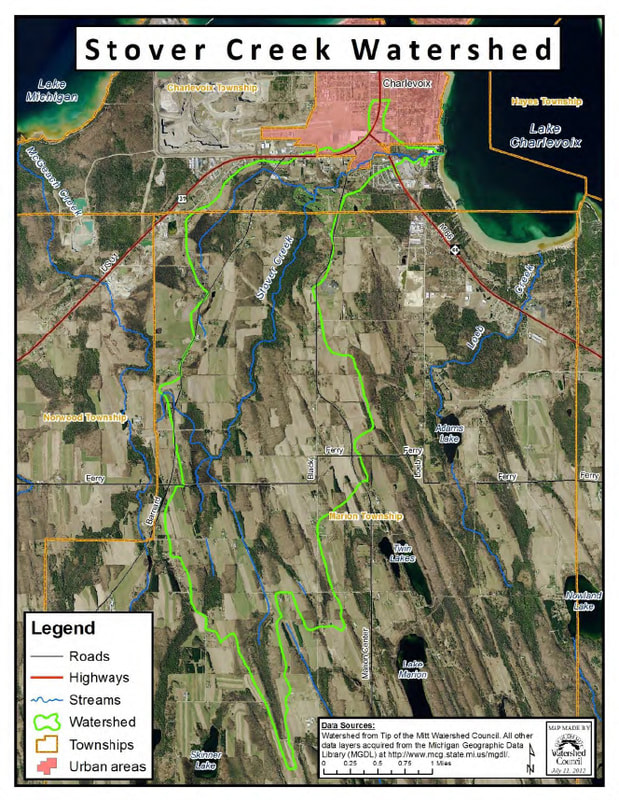
Stover Creek is an important cold water tributary within the Lake Charlevoix Watershed. It flows directly into Lake Charlevoix’s western basin, near the City of Charlevoix. The main channel of Stover Creek is 8-miles and the land area of its watershed encompasses 4,220 acres.
For decades, locals and resource agencies have had cause for concern given both the stream’s water quality measurements and anecdotal observations of the stream. In 2012, the Lake Charlevoix Watershed Management Plan, approved by both the Michigan Department of Environmental Quality and the Environmental Protection Agency, designated the Stover Creek Watershed as one of 16 acute critical areas. Acute critical areas are the priority locations where attention is needed first and foremost. Impacts to the Watershed, as described in the Lake Charlevoix Watershed Management Plan, follow:
|
Given these concerns, Tip of the Mitt Watershed Council (TOMWC), with support from the Charlevoix County Community Foundation, set out to examine the stream and its watershed to try to determine the leading causes of degradation. During 2013-2014, TOMWC conducted a comprehensive suite of resource inventories, including the land use, in-stream habitat, streambank erosion, road/stream crossings, stormwater, and water quality monitoring.


