Bear River
Watershed: Little Traverse Bay Watershed
Length: 15 miles
Headwaters: Walloon Lake and Springbrook Creek
Mouth: Little Traverse Bay
Length: 15 miles
Headwaters: Walloon Lake and Springbrook Creek
Mouth: Little Traverse Bay

Description:
Today, all but two of the historic dams have been removed from the river, restoring a more natural flow and passage of aquatic organisms. The Lake St. Dam, largest of the two, still remains near the mouth, interrupting fish like salmon and steelhead on their journey upstream to spawn, while at the same time preventing the invasive sea lamprey, which has had a disastrous effect on Great Lakes fisheries, from being able to use the river as spawning grounds. Upstream of the dam, the Bear River supports a native brook trout fishery.
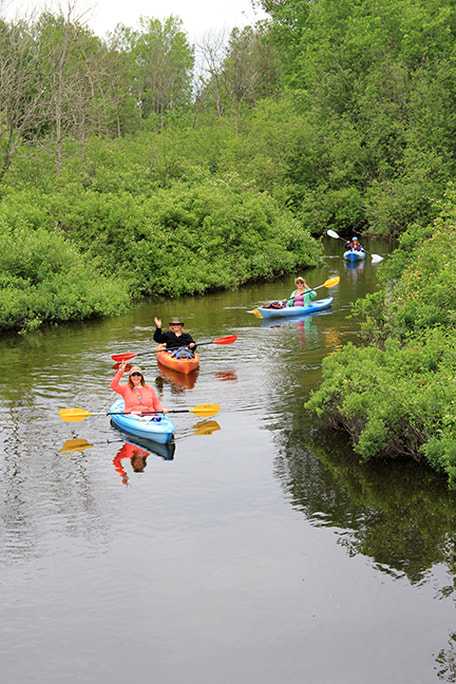
The Bear is vegetated along almost all of its length, and wildlife frequent its banks. It is a source of pride to members of the community, who use it for paddling, fishing, whitewater kayaking, wildlife viewing, morning walks, and many other forms of recreation.
Known Aquatic Invasive Species
Other Threats to Water Quality
- Nonpoint source pollution
- Eroding riverbanks
- Shoreline development
- Trash
- Habitat loss
- Road/stream crossings
|
Monitoring
The Bear River is monitored every three years through the Watershed Council’s Comprehensive Water Quality Monitoring (CWQM) Program for dissolved oxygen, specific conductivity, pH, nitrate-nitrogen, total nitrogen, total phosphorus, chloride levels, and total suspended solids. Biological monitoring is also performed by volunteers in the Bear River each spring and fall as part of the Watershed Council’s Volunteer Stream Monitoring (VSM) Program. |
This stream is monitored through the Little Traverse Bay Bands of Odawa Indians Surface Water Quality Protection Program (SWQPP).
The Little Traverse Bay Watershed Protection Plan and its Advisory Committee are working to protect the river, as it directly influences the water quality of the Bay.
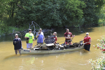
In addition, the river is cleaned annually by volunteers participating in the summertime “Healing the Bear” Bear River Cleanup
The Little Traverse Bay Watershed Protection Plan and its Advisory Committee are working to protect the river, as it directly influences the water quality of the Bay.
In addition, the river is cleaned annually by volunteers participating in the summertime “Healing the Bear” Bear River Cleanup
Additional Resources
Bear River Photos
Bear River Valley Recreation Area
The Bear River Valley recreation area features steep bluffs, unpaved trails, concrete path, boardwalks, whitewater rapids, and forest areas all in the heart of the City of Petoskey. The park is, for the most part, undeveloped and is currently used for primarily passive activities including hiking, cross-country skiing, fishing, kayaking, and environmental education.
Bear River Cleanup Video - 2013
Learn more about the project and why it is so important to the health of the Bear River and the Little Traverse Bay Watershed.
Information about Threatened, Endangered, and Special Concern species in this stream’s watershed is available on the Michigan Natural Features Inventory (MNFI) website.
USGS Current Water Data for Michigan provides stream flow conditions.
A wide variety of maps, including Vegetation circa 1800, National Wetlands Inventory, Land Cover Change 1800’s to 1978, Wetland Change 1800’s to 1980, and many other resources for this area are available online in the Michigan Natural Features Inventory (MNFI) Data Resources page.
Learn about safely eating fish from this river in the Michigan Fish Consumption Advisory.
Publications
To read the survey report, click here:
- Bear River Greenbelt Survey 2011
- A Biological Survey of the Bear River Watershed and Selected Emmet County Stream in Charlevoix and Emmet Counties (MDEQ Water Bureau, June 2005)
- A Water Quality Summary of the Bear River (2010)
- Bear River Watershed Invasives Management Plan (2010)
- Bear River Greenbelt Survey (2011)
- Volunteer Water Quality Monitoring Report (2014)


